


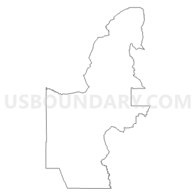
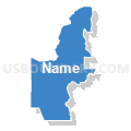
Sandoval County Precinct 27, Sandoval County, New Mexico
About
Outline
Summary
| Unique Area Identifier | 623918 |
| Name | Sandoval County Precinct 27 |
| County | Sandoval County |
| State | New Mexico |
| Area (square miles) | 890.63 |
| Land Area (square miles) | 890.39 |
| Water Area (square miles) | 0.24 |
| % of Land Area | 99.97 |
| % of Water Area | 0.03 |
| Latitude of the Internal Point | 35.58837080 |
| Longtitude of the Internal Point | -107.08696480 |
Maps


Graphs
Select a template below for downloading or customizing gragh for Sandoval County Precinct 27, Sandoval County, New Mexico


Neighbors
Neighoring Voting District (by Name) Neighboring Voting District on the Map
- Bernalillo County Precinct 31, Bernalillo County, NM
- Bernalillo County Precinct 57, Bernalillo County, NM
- Cibola County Precinct 2, Cibola County, NM
- McKinley County Precinct 11, McKinley County, NM
- McKinley County Precinct 14, McKinley County, NM
- Rio Arriba County Precinct 30, Rio Arriba County, NM
- Sandoval County Precinct 14, Sandoval County, NM
- Sandoval County Precinct 15, Sandoval County, NM
- Sandoval County Precinct 17, Sandoval County, NM
- Sandoval County Precinct 21, Sandoval County, NM
- Sandoval County Precinct 22, Sandoval County, NM
- Sandoval County Precinct 25, Sandoval County, NM
- Sandoval County Precinct 30, Sandoval County, NM
- Sandoval County Precinct 63, Sandoval County, NM
- Sandoval County Precinct 78, Sandoval County, NM
Top 10 Neighboring County Subdivision (by Population) Neighboring County Subdivision on the Map
- West Bernalillo CCD, Bernalillo County, NM (7,796)
- Crownpoint CCD, McKinley County, NM (5,609)
- Cuba CCD, Sandoval County, NM (4,986)
- Jemez-Zia CCD, Sandoval County, NM (4,544)
- Laguna CCD, Cibola County, NM (4,459)
- Coyote CCD, Rio Arriba County, NM (1,288)
Top 10 Neighboring Place (by Population) Neighboring Place on the Map
Top 10 Neighboring Unified School District (by Population) Neighboring Unified School District on the Map
- Albuquerque Public Schools, NM (667,445)
- Gallup-Mckinley County Schools, NM (63,611)
- Grants-Cibola County Schools, NM (27,088)
- Jemez Valley Public Schools, NM (5,273)
- Cuba Independent Schools, NM (4,584)
- Jemez Mountain Public Schools, NM (1,510)
Top 10 Neighboring State Legislative District Lower Chamber (by Population) Neighboring State Legislative District Lower Chamber on the Map
- State House District 29, NM (59,097)
- State House District 44, NM (51,046)
- State House District 60, NM (41,212)
- State House District 12, NM (38,723)
- State House District 43, NM (27,235)
- State House District 69, NM (26,984)
- State House District 65, NM (26,930)
- State House District 41, NM (23,742)
Top 10 Neighboring State Legislative District Upper Chamber (by Population) Neighboring State Legislative District Upper Chamber on the Map
- State Senate District 23, NM (84,821)
- State Senate District 22, NM (60,988)
- State Senate District 30, NM (48,188)
Top 10 Neighboring 111th Congressional District (by Population) Neighboring 111th Congressional District on the Map
- Congressional District 1, NM (701,939)
- Congressional District 3, NM (693,284)
- Congressional District 2, NM (663,956)
Top 10 Neighboring Census Tract (by Population) Neighboring Census Tract on the Map
- Census Tract 9406, Bernalillo County, NM (9,385)
- Census Tract 9747, Cibola County, NM (6,660)
- Census Tract 4, Rio Arriba County, NM (4,766)
- Census Tract 112, Sandoval County, NM (2,729)
- Census Tract 9409, Sandoval County, NM (2,668)
- Census Tract 109, Sandoval County, NM (2,318)
- Census Tract 9440, McKinley County, NM (2,186)
- Census Tract 9406, Sandoval County, NM (1,815)
Top 10 Neighboring 5-Digit ZIP Code Tabulation Area (by Population) Neighboring 5-Digit ZIP Code Tabulation Area on the Map
- 87013, NM (5,200)
- 87026, NM (4,063)
- 87024, NM (2,214)
- 87025, NM (1,237)
- 87053, NM (998)
- 87014, NM (654)